The Geography of AIDS New York
Subscribe
https://meridian-archive.com/feed.xmlOpen in your app, or paste the link above into any other:
The Geography the City Kept on File
More than half of the AIDS-related discharges recorded at Bronx-Lebanon Hospital in 1991 came from just two ZIP codes.1 The number surfaces in a 1993 report from a U.S. National Research Council panel convened to advise Congress on the epidemic in New York City — a document written for public-health administrators and budget staff, not for anyone who walked the blocks it described, and the two-ZIP-code line went to press as a single figure in a table, unremarked on by the panel that printed it. The city’s own Health Department worked the same way: the epidemic was mapped by borough, by neighborhood, sometimes by postal code, in planning documents built to size bed counts and clinic budgets, the ordinary administrative business of an agency deciding where to put money. Nobody on the wards needed a federal panel to tell them where their patients came from — the concentration showed up first as a scheduling problem, an overflow of AIDS patients onto medical and surgical floors that carried no AIDS designation because the twenty-two beds built for the purpose filled every week of the year.
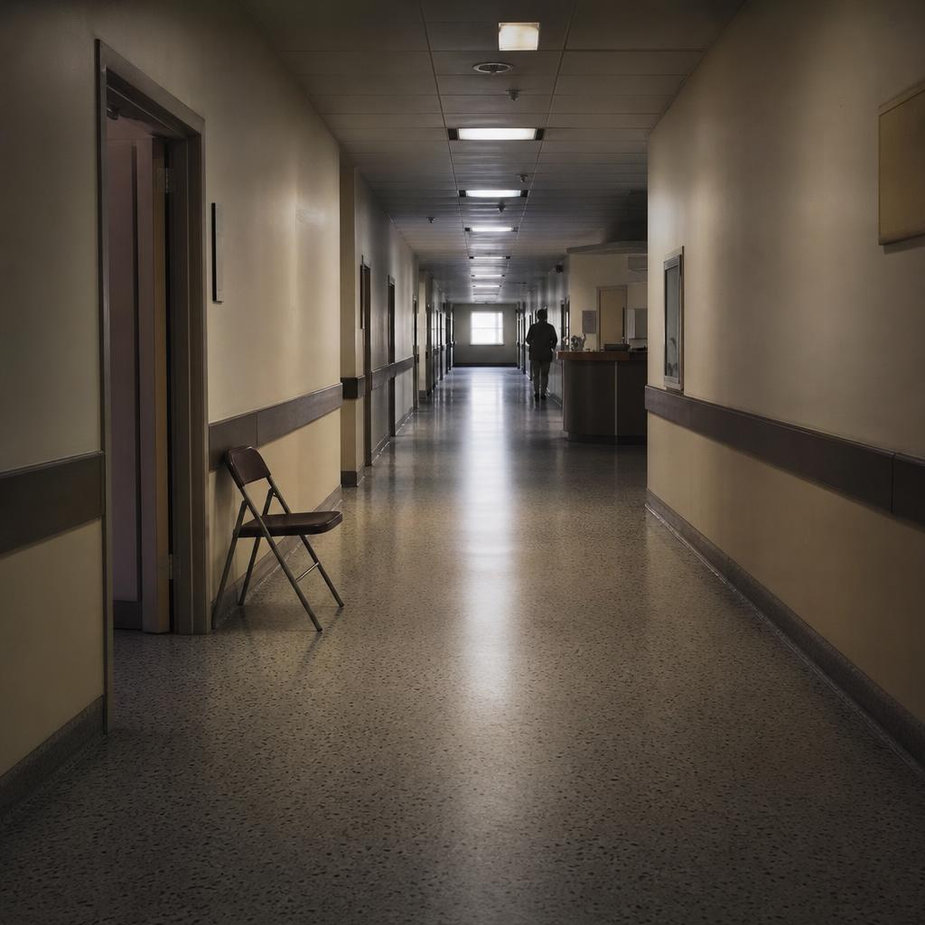
St. Vincent’s Hospital, on the other geography entirely — Manhattan below Fourteenth Street rather than the South Bronx — built its own workarounds into daily operation. The hospital had stood at the corner of Seventh Avenue and Eleventh Street since 1849, founded by the Sisters of Charity, and by the early 1980s its emergency room — at the meeting of Greenwich Village, Chelsea, and the Meatpacking District — was the first place in the city where the pattern became visible. Young men arrived with weight loss, rare pneumonias, infections the literature had no settled name for. The recognition happened in the emergency room before it happened in the journals. In 1984 the hospital opened the first dedicated AIDS ward on the East Coast, twenty beds on a seventh floor; by the end of the decade the unit had spread across the whole floor, and patients were dying in the hallways while they waited for beds.2
The ward kept its own rules. Visiting hours, enforced everywhere else in the building, were effectively abolished on the AIDS floor; lovers stayed the night; the staff bent the hospital’s regulations to allow the dying some privacy and some company. One patient asked to have the route of the Greenwich Village Halloween parade diverted past the ward, and when it could not be, a nun lent him her habit for the day. In 1989, after a security guard ejected a man for kissing his dying lover, ACT UP occupied the emergency waiting room and covered the crucifixes with condoms.2 The elevator opened directly onto the floor, and the people who came often enough pressed the button without looking. Across Seventh Avenue stood a low materials-handling building linked to the hospital by a tunnel beneath the avenue, the route by which supplies came in and the dead went out.
Two blocks north, at 208 West Thirteenth Street, was the building everyone called the Center. It had been a public school; in December 1983 the city sold the disused structure to the Lesbian and Gay Community Services Center for a million and a half dollars. On the night of March 12, 1987, Larry Kramer stood in a second-floor room and told the men in it that a large share of them would be dead within five years; two days later the room reconvened and became ACT UP.3 From then on the Center’s Monday-night meeting was the movement’s engine — two or three hundred people most weeks, swelling toward a thousand before the largest actions, spilling over to Cooper Union when the room could not hold them. The building also housed the older gay men’s service organization, a congregation, and a dozen other functions; by the mid-1990s it was the largest institution of its kind on the East Coast.
Where Christopher Street ran into the West Side Highway stood Bailey-Holt House, opened in 1986 by the AIDS Resource Center as the first congregate residence for people with AIDS in the country. Its placement was the point: on a corner visible from every cab heading downtown on the highway and every walker along the waterfront, it declined to hide its residents. The New York Times covered the opening under the headline “For Homeless with AIDS, a New Home” — a sentence whose appearance in the paper of record was itself an event.4 By 1990 an estimated thirteen thousand people in the city were both homeless and HIV-positive; the house held a few dozen of them, on a corner no passerby could miss.
Across the highway from the house lay the flat cleared ground where the Christopher Street piers had been. A decade earlier the piers had been the open-air center of gay life on the waterfront; they had been demolished and the ground left as broken asphalt behind a chain-link fence. The dying inside Bailey-Holt and the emptied piers across the road held between them the whole distance the neighborhood had traveled in ten years.
What Had Already Closed
By 1989 much of the downtown map was already a record of what had closed. The room the gay city had built for itself at its most expansive was gone before the decade the magazines were living in had properly begun.
The Saint had opened in 1980 inside the shell of the old Fillmore East on Second Avenue — a members’ discotheque under a planetarium dome, the grandest room of its kind downtown.5 Within two years the epidemic was thinning its membership. The owner lowered the initiation fee and opened nights to a straight crowd to keep the room solvent; the club’s signature parties, once frank, were reduced by the middle of the decade to performances of safe sex, and then to pantomime. The Saint closed for good over forty continuous hours in the spring of 1988, and the dome came down. For a period gay men had half-believed the disease could be caught from the club’s water fountain.
The bathhouses had gone earlier and more bitterly. St. Mark’s Baths, the largest in the city, was shut by New York State emergency order at the end of 1985. The closure divided the men it affected: some supported it as a public-health necessity, others opposed it as the state reaching for a pretext to police gay life. The argument was not settled at the time and did not resolve cleanly afterward; it was the first form of a question — whether the epidemic was best fought through changed behavior, individual liberty, state regulation, or medicine — that the following fifteen years asked again in every register.6
Not everything closed. The Pyramid Club on Avenue A, open since 1979, kept going — drag and downtown rock and the rougher, weirder end of the East Village night, the place people went when the grander rooms were gone. It outlasted the decade. But the pattern of the map was subtraction, and a person walking the East Village in 1989 was moving among recent absences as much as among survivors.
Two Neighborhoods
The East Village was the center of the downtown art world and the neighborhood where that world was dying fastest. The painter and writer David Wojnarowicz kept a loft at 189 Second Avenue; his mentor, the photographer Peter Hujar, had died there in 1987, photographed on his deathbed by Wojnarowicz in images that became some of the period’s central documents. Cookie Mueller, the writer and scene figure, died in 1989. The galleries that had made the neighborhood — Civilian Warfare, Gracie Mansion, Pat Hearn, PPOW — showed the work and buried the artists in the same years. In 1985 a part-time waiter’s wages could still cover a room here; the neighborhood was gentrifying through the early 1990s, the process accelerating after the confrontation in Tompkins Square Park in 1988, so that the same blocks were at once a center of dying and an engine of real-estate appreciation for the buyers who came next.7
Chelsea, in 1989, was still largely working-class and Latino, with a growing gay population along Eighth Avenue. Across the following decade the strip between Fourteenth and Twenty-third Streets became a long, thin village of bars and gyms — the Eagle, Splash, Rawhide, and the rest — and by 2001 the neighborhood was fully gay, with the high-end retail to match. The “Chelsea Boy” look that hardened into an aesthetic in the late 1990s — gym-built, groomed, the white T-shirt — arrived in the same years the new drugs did, and it carried a fact inside it: to be able to perform it at all was to have survived.
The Moral Geography
Uptown, at Fifth Avenue and Fiftieth Street, the map acquired a different kind of landmark. Cardinal John O’Connor was Archbishop of New York from 1984 through nearly the whole of the period, and he opposed condoms, safe-sex education in the public schools, and needle-exchange programs; he held that the way to avoid the disease was to live morally, and he said so from the most visible pulpit in midtown, with the mayor often in the pews. On December 10, 1989, several thousand protesters surrounded St. Patrick’s Cathedral and a small group staged a die-in inside during Sunday Mass; more than a hundred people were arrested. It was the most divisive action of the period, condemned across the political spectrum, and among the most effective — it put the archdiocese’s positions on the front page of nearly every paper in the country.
Downtown kept its counter-pole in Judson Memorial Church on Washington Square South, a progressive congregation with a long habit of sheltering the movement. On the night of November 2, 1992, the eve of a presidential election, an open coffin was carried out of Judson and up Sixth Avenue in the rain, forty blocks, to the reelection headquarters of the sitting president. The man in the coffin had asked for exactly this: a funeral that was also an accusation. The political funeral, as a form, had almost no precedent in American protest, and it belonged to a narrow band of years; when the dying slowed, it stopped.
The moral geography did not resolve into sides. The same church that produced the cardinal ran, through the Sisters of Charity, the hospital where more of the city’s AIDS patients were nursed than anywhere else. Both facts sat on the same few square miles.
The Other Map
Everything on the walkable map lay in Manhattan below the Fifties, and everything on it was, disproportionately, the epidemic as it reached white gay men. But that was never where the disease was most concentrated. By 1990 the cumulative rate of AIDS diagnoses in some neighborhoods had reached about one adult in every hundred, and those neighborhoods were the South Bronx, parts of Harlem, the Lower East Side, Bedford-Stuyvesant, East New York, and stretches of the Rockaways.8 They were poor, they were Black and Latino, and in them the disease traveled mainly through shared needles rather than through sex.
The Bronx had its own pattern, documented early. A 1989 study out of Montefiore found that among the borough’s AIDS patients, “62.2% … are intravenous drug users, 20.3% are female, 87.3% are black or Hispanic, and 4.5% are children under age 13 years.”9 Roughly forty thousand people in the Bronx injected drugs, and something between forty-five and fifty-five percent of them were thought to carry the virus. The neighborhoods where this concentrated — Mott Haven, Hunts Point, Highbridge, Morris Heights, Crotona-Tremont, Morrisania — were the same blocks the crack trade and the drug-sentencing laws were running through at the same moment.
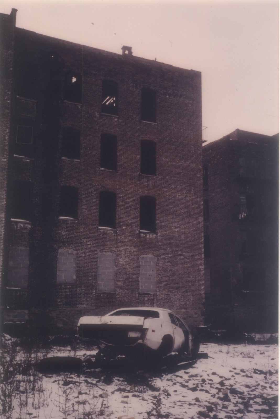
The institutions were overwhelmed and improvised. Bronx-Lebanon Hospital carried between a hundred and a hundred and twenty HIV and AIDS inpatients on an average day in 1991, against a dedicated unit of twenty-two beds; the rest lay on ordinary wards.1 The pediatric epidemic had been identified in the borough as early as 1981, by Arye Rubinstein at Albert Einstein, and by the early 1990s a single federally funded pediatric AIDS trials unit served the whole Bronx. A citywide survey of newborns found that about one mother in eighty was HIV-positive; among African-American mothers the rate was more than double that, and the highest rates fell in the central Bronx and northern Manhattan.10
The Other Geography in Numbers
| Measure | Figure |
|---|---|
| Bronx AIDS patients, 1989: intravenous drug users / Black or Hispanic / under age 139 | 62.2% / 87.3% / 4.5% |
| Cumulative adult AIDS rate, hardest-hit neighborhoods, by 19908 | up to ~1 in 100 |
| Bronx-Lebanon daily HIV/AIDS inpatient census, 19911 | 100–120 (22-bed unit) |
| NYC newborns whose mothers were HIV-positive, 1987–9010 | ~1.24% overall; ~2.21% among African-American mothers |
Across the river the same arithmetic held in Bedford-Stuyvesant and Bushwick — transmission through injecting partners, from mothers to infants, and a parallel epidemic driven by the exchange of sex for crack. The women dying in these neighborhoods were, in the great majority, Black or Latina, and most had been infected by partners who used drugs. Among the city’s young men, by the end of the decade’s first years, AIDS had become the leading cause of death, ahead of homicide and heart disease alike.
This was the epidemic at its largest, and it was the epidemic the magazine world mostly did not cover. The deaths it recorded were the artists’ — Robert Mapplethorpe in the spring of 1989, Keith Haring and Halston the following winter, the downtown face and the famous face. The Village Voice and the Nation reported the other map; the glossy monthlies largely did not, not until around 1993, when the rising death rate among heterosexual women became difficult to keep off the page. By then the gap between whom the disease was killing and whom the coverage mourned was wide enough to see from either side.
When the combination therapies arrived at the end of 1995 and through 1996, the emergency on the walkable map began to ease. Annual deaths in the city, which had run to around seven thousand at the peak, fell by nearly half within two years; the ward at St. Vincent’s was no longer at capacity; the Saint was gone, replaced by an apartment building; the Monday meeting at the Center thinned to a fraction of its size. On the other map the decline came later and less completely. By 2001 the center of the American epidemic had moved out of New York entirely, toward the rural South, and within the city it had settled deepest into the neighborhoods that had never carried a landmark on anyone’s map.
Every epidemic has a geography, and this one had two. The first was small enough to walk: a hospital, a meeting hall, a house for the dying, a shuttered disco, all within a mile of one another below Fourteenth Street, each building known by heart to the people who spent the decade going in and out of them. The second was larger and had no walk. It ran through the wards of the Bronx and the apartments of Bedford-Stuyvesant, through people who injected drugs and the children born to them, through blocks where by 1990 one adult in a hundred had been diagnosed and no one downtown could have named the street. Both maps were true. The people who lived on the first were not wrong about what they saw — they watched their friends die, and they built institutions and a language and an art out of the dying, and the record they left is one of the great records of the century. They were only wrong about its edges: about where the map stopped, and how much of the epidemic lay past the last street they knew by name. A city, like a magazine, sees most clearly the part of itself it already lives in. What it does with the rest is the longer question.
The magazine would have marked the season’s deaths in the Back, as it had since the middle of the 1980s: the photographer in the spring of 1989, the designer and the muralist the following winter, each someone it had published or shot with. A profile of the East Village painter at the height of his fight with Washington would have been assigned in a sentence; a photo essay from the ward at St. Vincent’s would have been the kind of piece the Feature Well existed to run. Holding the National Magazine Award, in Public Interest, that 1988 had brought it, it would not have doubted that the epidemic was its story.
The story with the higher stakes would have reached the Tuesday lunch and stopped there. One of the editors would have proposed the other map — the Bronx wards, the infected newborns, the women dying of a disease the floor still filed under the funerals of artists — and the objection that carried would have been the art department’s before it was anyone’s politics: the downtown map came with buildings the reader could picture — a ward, a meeting hall, a house on a visible corner — and with faces the magazine had already published; the other map would have offered the photo editor no landmark, no name in the files, no address a caption could hold. A geography without a place to stand the camera, someone would have said, and in a book whose epidemic coverage lived on its photography, the sentence would have ended the discussion. The objection would have been reasonable. The piece would have been declined for reasons every editor at the table would have found reasonable, and the room would have turned to the cover.
The woman who cleaned the seventh floor would have started her shift at six, after the desks emptied, and worked the bullpen in the dark with a cart and a radio turned low. She would have been from the Grand Concourse, or from Morrisania, or from one of the blocks the declined piece would have named. She would have emptied the ashtrays and wiped down the light tables in the photo department, where the transparencies of the dead were still clipped to the boards. She would have had a brother, or a son, on a regular ward at Bronx-Lebanon, on no list any editor kept, in the middle of the epidemic the floor had decided was someone else’s to cover. The senior editor leaving late would have passed her cart and known her as a fixture of the late shift. She would have known him the same way. Neither would have known that the story the floor had set aside at lunch was riding the car down with them.
Footnotes
-
National Research Council, The HIV/AIDS Epidemic in New York City (National Academy Press, 1993). ↩ ↩2 ↩3
-
New York City LGBT Historic Sites Project, “St. Vincent’s Hospital (Manhattan),” nyclgbtsites.org. The ward’s abolished visiting hours, the diverted Halloween parade, and the 1989 emergency-room occupation are drawn from oral-history accounts collected there. ↩ ↩2
-
Sarah Schulman, Let the Record Show: A Political History of ACT UP New York, 1987–1993 (Farrar, Straus and Giroux, 2021). ↩
-
David W. Dunlap, “For Homeless with AIDS, a New Home,” New York Times, January 1987. ↩
-
“Nightclubbing: The Saint,” Red Bull Music Academy Daily, 2015. ↩
-
Randy Shilts, And the Band Played On: Politics, People, and the AIDS Epidemic (St. Martin’s Press, 1987). ↩
-
Cynthia Carr, Fire in the Belly: The Life and Times of David Wojnarowicz (Bloomsbury, 2012). ↩
-
Thomas et al., American Journal of Epidemiology 137, no. 2 (1993): 121–130 — cumulative AIDS rates reaching roughly 100 per 10,000 adults in the hardest-hit neighborhoods by 1990. ↩ ↩2
-
Drucker et al., American Journal of Epidemiology 130, no. 1 (July 1989): 133–142, Department of Epidemiology and Social Medicine, Montefiore Medical Center. ↩ ↩2
-
Novick et al., New York City Department of Health Newborn HIV Seroprevalence Study, 1991 (359,470 newborns tested, November 1987–September 1990). ↩ ↩2