Visual Date-Stamping: What a Photograph Would Instantly Show
Subscribe
https://meridian-archive.com/feed.xmlOpen in your app, or paste the link above into any other:
The Restaurant That Counted Its Chairs
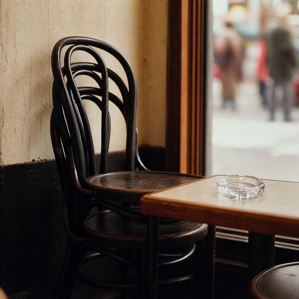
The Smoke-Free Air Act, signed January 10, 1995, did not ban smoking in restaurants; it banned smoking in restaurants with seating for more than thirty-five.1 The number was not a public-health estimate rounded for convenience — it was a legal boundary a restaurant crossed or did not, and the city’s Department of Health enforced it by chair count rather than by square footage, revenue, or any other proxy an inspector might have used. A room with thirty-four seats could keep its ashtrays on the tables; the same room with a thirty-sixth chair added could not, and the addition or removal of a single seat was, for the purposes of the statute, the difference between a legal smoking section and a violation. Restaurateurs near the line adjusted their seating plans accordingly, and for the duration of the period a dining room’s chair count was, in a narrow bureaucratic sense, also a determination of its air. A magazine editor taking a lunch meeting at a thirty-four-seat room in 1996 could light a cigarette between courses; a magazine editor at a thirty-six-seat room two doors down could not.
The skyline underwent a slower kind of editing, and it was, in its own way, the most stable element in any photograph of Manhattan between 1989 and 2001 — also the most useful for dating it. The Twin Towers of the World Trade Center — the North Tower at 1,368 feet to the roof, the South Tower at 1,362 feet — rose above the lower Manhattan skyline from December 1972 onward and were present in every photograph that captured the downtown horizon from any angle until 9:59 in the morning on September 11, 2001, when the South Tower came down, followed twenty-nine minutes later by the North.2 The Towers were the controlled variable. Almost nothing else was.
The other fixed anchors of the skyline were older and less debated. The Empire State Building, at 1,250 feet to the antenna base, had been the tallest building in the world until the Towers surpassed it in 1972 and by 1989 wore its antenna as a radio transmission mast rather than a trophy. The Chrysler Building, at 1,046 feet, remained the most photographed spire in Midtown, its stainless-steel crown unchanged since 1930. The Citicorp Center’s angled, flat-cut roofline at 53rd and Lexington served as the third Midtown landmark recognizable to any viewer oriented by the skyline rather than the grid.2
The skyline was also edited by sign. The building above Grand Central Terminal that bore the name Pan Am on its facade in large illuminated letters became the MetLife Building in September 1992, after Pan Am had ceased operations the prior year and the building’s owner since 1981, MetLife, replaced the wordmark with its own.3 The wordmark above Park Avenue read Pan Am until September 1992 and MetLife from that month on, with no interval in which it read neither.
The skyline was edited by addition at its edges. Trump Tower, on Fifth Avenue at 56th Street, had been completed in 1983 and was a constant through the period — its pink-marble atrium and sawtooth profile a recognizable feature of the Fifth Avenue Midtown canyon. Trump World Tower, at First Avenue and 47th Street on the East Side, was a different project: construction began in the late 1990s and the building topped out in 2001 at 861 feet, briefly the tallest residential tower in the world.4 Slim, dark-glass, rising against the UN complex and the Queensboro Bridge, it had no place in the East Side skyline before 2001.
4 Times Square, the Durst Organization tower at 42nd Street and Broadway, rose between 1996 and 1999 and topped out at 809 feet including its broadcast spire.5 Its construction was visible from the street throughout the late 1990s: a structural steel core climbing above the theater marquees, then a glass-and-steel skin enclosing it floor by floor. It was the first large commercial skyscraper built in Midtown since the mid-1980s recession had halted office construction, and its arrival on the west side of Times Square was readable from several avenues away by the time the last floor was enclosed. Every Midtown skyline photograph taken after late 1999 reads either “the NASDAQ cylinder on its southeast corner is lit” — illuminated December 1999 — or “the building is complete but the cylinder is dark,” a distinction that provides a window of a few weeks at most.6
Times Square as a Decade Clock

The square’s surface inverted twice between 1989 and 2001 — once in its lighting technology, once in its tenants — and the two inversions proceeded on partially overlapping calendars.
On the question of light, the change was a matter of engineering economics. In 1989, the signage along Broadway from 42nd to 47th Street ran on neon tubes and incandescent bulbs: the red-blue-white palette of the old entertainment district, gas and filament, maintained by sign shops whose stock-in-trade was the physical craft of bending glass and wiring transformers. Neon was expensive to maintain — tubes cracked, transformers failed, a dark section of a large sign stayed dark until a repair crew could reach it — but it was the established medium, and the aesthetics of Times Square in its pre-renovation form were inseparable from it. Animated LED displays capable of full-color video did not appear in the square in commercial quantity until the mid-1990s, and their spread was gradual enough that a photograph from 1994 and a photograph from 1999 would show markedly different proportions of the two technologies on the same blocks.
On the question of tenants, the calendar was more precise. The New Amsterdam Theatre at 214 West 42nd Street had been dark since 1983 and was in active deterioration through the late 1980s; its interior, once the most ornate on Broadway, was by 1992 a ruin of collapsed plasterwork and water-damaged murals. In May 1995, Disney Theatrical signed a forty-nine-year revenue-sharing lease on the building with the city and state of New York, which had acquired it through the 42nd Street Development Project.7 The renovation by Hardy Holzman Pfeiffer Associates ran through 1996 and into 1997. The theatre reopened on April 2, 1997, with the musical King David; The Lion King moved in on November 13, 1997, and ran continuously thereafter.7 A photograph of West 42nd Street between Seventh and Eighth Avenues taken in early 1997 shows scaffolding still on the New Amsterdam’s facade. A photograph taken after November 1997 shows the Disney signage on the marquee.
The Condé Nast move north was the signal event for the media industry’s geography. The company’s titles — Vogue, Vanity Fair, GQ, Allure, Glamour, and the rest — had occupied 350 Madison Avenue, at 45th Street, since the mid-1980s, running their editorial floors from a building entered off Madison itself.8 The New Yorker, acquired by S.I. Newhouse in 1985, kept separate quarters through the decade at 25 West 43rd Street and did not join the rest of the company’s titles until the move north was complete.8 In 1996 the Durst Organization signed Condé Nast as the anchor tenant for 4 Times Square, which was then in its early construction phase. The corporate move from 350 Madison began on June 21, 1999, with roughly two hundred staff; the remaining floors followed through the end of 1999 and into January 2000.8 A photograph of the Madison Avenue entrance in 2000 shows a building in transition; a photograph of the 4 Times Square lobby in 2000 shows a building in full operation.
The NASDAQ MarketSite cylinder, seven stories tall and positioned at the southeast corner of 4 Times Square facing Broadway, was illuminated in December 1999, adding a large-format LED display at street level along the southeast corner.6 After that date, every clear-sky evening photograph that includes that corner from the south is night-lit by it. The same corner at the same hour in a photograph from 1998 is dark above the theater marquees.

What Came Off the Walls
The walls of the city were a public record of what was legal to sell and to whom, and between 1989 and 2001 the register was revised in ways that were visible from the street.
Tobacco advertising had been part of the landscape since the mid-twentieth century, and through the late 1980s it remained prominent on the exteriors of Midtown buildings, on taxi-top placards, and on bus shelter panels. The Marlboro Man appeared on the side of buildings along Seventh Avenue and Broadway; Newport and Camel ran prominent bus-shelter campaigns; the tobacco company names were on many of the largest-format billboard leases in the district. The 1998 Master Settlement Agreement, signed between forty-six state attorneys general and the major tobacco companies in November of that year, included provisions restricting outdoor advertising of tobacco products.9 The restrictions took effect in stages over 1999, and the physical consequence was visible in the Times Square and Midtown advertising landscape by mid-year. The Marlboro Man on the side of the building at Broadway was replaced by a different category of advertiser. A photograph of any large-format outdoor tobacco installation in the square after late 1999 does not exist.
The indoor smoking landscape changed on the same calendar as the chair-counted dining rooms. The Smoke-Free Air Act also banned smoking outright in workplaces of any size, with no seating threshold to hide behind; bars and smaller restaurants remained exempt through the period, and the citywide extension to bars lay beyond it. The practical effect for office buildings was immediate: a magazine floor in early 1995 had ashtrays on desks and a light cloud of ambient smoke visible in conference rooms; a magazine floor in late 1995 had a designated smoking room near the stairwell and a visible absence of the desktop ashtray. A photograph of a Midtown office interior that shows someone smoking at a desk is pre-January 1995.
The city’s coffee landscape was edited by a single national chain’s arrival. The first Starbucks location in New York City opened in April 1994 at 87th Street and Broadway on the Upper West Side.10 The expansion through Manhattan was steady through the mid-1990s; by 1998 the green-and-white awning was present on a significant share of Midtown commercial blocks, and by 2001 the company had dozens of locations across Manhattan. No Starbucks awning existed at street level before that month; the density of the awning in any given neighborhood, thereafter, was a rough index of the year within the following decade.
The bank names on Midtown façades were edited through the period by a wave of corporate mergers, leaving successor institutions on signage that had previously borne older banks. The branch façades and ATM surround panels updated with each merger cycle; the bank-name register a viewer in 1989 read fluently was a different register by 2001.
Bryant Park, closed for reconstruction since 1988, reopened on April 22, 1992, with a redesign that replaced the chain-link fencing and deteriorated lawn with hedged borders, gravel paths, movable iron chairs, and a kiosk cluster at both Sixth and Fifth Avenue edges.11 Before April 1992, photographs of the south face of the New York Public Library show construction fencing and an empty field. After that date they show a managed public space. The Bryant Park Grill restaurant opened on the library terrace in 1995, adding a permanent commercial structure to the east end of the park that was visible from 42nd Street. The walls of the city included the visible perimeter of its public spaces; Bryant Park’s perimeter was a different kind of wall in 1989 and a different kind again in 1999.
The Body, the Hand, the Train
The objects pedestrians carried, the trains they boarded, and the cards they inserted into slot readers shifted on a documented calendar that a photograph could read with reasonable precision.
The hand was the most efficient single marker. In 1989, a mobile phone in a pedestrian’s hand was a Motorola DynaTAC or one of its contemporaries — roughly the size and weight of a large hardcover book, with a retractable antenna that extended several inches above the ear and a battery that supplied roughly thirty minutes of talk time before requiring a recharge cycle measured in hours. The device was associated with real estate, finance, and senior media; it was expensive to own and expensive to operate, and the population of users was correspondingly narrow. Pagers — the Motorola Bravo and competing devices — were spreading through professional networks and through some youth demographics. By 1994 to 1996, cellular service had expanded significantly; Sprint and AT&T Wireless had introduced digital PCS networks that lowered per-minute costs, and cell phones were common enough among professional-class New Yorkers to appear regularly on Midtown sidewalks. The Motorola StarTAC flip phone, introduced in 1996 at roughly $1,000 unlocked, accelerated a format shift; by 1997, the clamshell flip phone was the visible standard for anyone carrying a mobile device. A photograph showing a large-format brick phone at someone’s ear places the user in roughly 1989 to 1993. A photograph showing a compact flip phone at someone’s ear is 1997 or later.
The fare instrument in the subway ran on a parallel timeline. The token — a small brass disc with a Y-shaped cutout at its center — had been the standard fare medium since 1953, and it remained so through the early 1990s.12 The MetroCard program introduced a magnetic-stripe card as an alternative. On June 1, 1993, the first three thousand test cards were distributed. On January 6, 1994, the first MetroCard-capable turnstiles opened at the Wall Street station on the 4 and 5 lines and at Whitehall–South Ferry on the N and R.12 The card-reading turnstile — a thin chrome housing with a horizontal swipe slot on the right side — was visually distinct from the token turnstile it was replacing, and a photograph of a subway entrance that shows it is post-January 1994. The system went fully MetroCard-capable on May 14, 1997, with free bus-to-subway transfers beginning on July 4, 1997.12 Seven-day and thirty-day unlimited-ride MetroCards arrived on July 4, 1998, and the first MetroCard vending machines were installed on January 25, 1999.12 Tokens remained legally valid through the period and beyond, but the proportion of riders using them declined steadily from 1997 onward. A photograph of a hand pressing a token into a coin slot is plausible anywhere in the period; a photograph of a hand swiping a yellow-and-blue card at a thin chrome reader is post-January 1994.

The trains themselves were a layered archive. The clean-train policy reached its documented endpoint on May 12, 1989; from that date, clean steel and painted-red Redbird livery were the only versions of the subway a camera could find.13
New car classes followed on a documented schedule. On June 15, 1993, the first R110A prototypes — wider doors, electronic strip-map displays, recorded stop announcements — entered service on the 2 line, followed by R110B cars on the A line.14 These were prototypes, ordered in small quantities for evaluation, and their presence in a photograph marks the frame clearly as post-June 1993. The production-fleet replacement began at scale when the R142 cars, built by Bombardier, and the R142A cars, built by Kawasaki, entered service on July 10, 2000, assigned initially to the 2 and 4 lines and beginning to retire the painted-red Redbird IRT cars that had been in service since the 1950s and 1960s.14 The Redbirds were identifiable from their exterior livery — a painted red stripe along the stainless-steel body — and from their interior, which had bucket seats in an orange-tan plastic and overhead fans rather than air conditioning on the older models. The R142s had perimeter seating, LCD passenger information displays, and a notably different interior atmosphere. A photograph of an IRT car interior showing bucket seats and painted-red livery visible through the windows is pre-2000. A photograph showing perimeter seating and an LCD strip map is 2000 or later.
In 1989, a pedestrian at the 42nd Street IRT entrance paid with a coin, boarded a clean car that had been a tagged car six months earlier, sat in a bucket seat, and looked up through a window at a skyline with a Pan Am sign above Grand Central and a Marlboro Man on the nearest building wall. In 2001, the same entrance accepted a card, the car was a newer model or a Redbird near the end of its service life, the wall held neither Marlboro nor Chemical Bank, and the sign above the nearest building read MetLife. None of these changes had been the purpose of the photographs taken along the way. All of them were in every photograph anyway.
A photograph made in New York City between 1989 and 2001 carried its date on its surfaces. The height of the towers above the lower Manhattan skyline, the sign on the building above Grand Central, the color and format of the fare card, the device at the pedestrian’s ear, the awning above the coffee shop door, the name on the bank facade, the advertising category on the bus shelter panel — each registered a policy, a settlement, a merger, a technology release, a corporate relocation, a court agreement with tobacco executives. The viewer standing inside the frame could not have assembled these signals into a reading of the year because the changes arrived one at a time, spaced months or years apart, absorbed into the familiar background as each one occurred. That is how a city changes: not all at once, not legibly to the people inside it, but continuously and at the surface, where the camera can always find it. The year’s work was done in interior rooms, but the year was already written outside, on every wall and in every hand, before anyone went in.
Meridian would have caught the Pan Am sign’s replacement only glancingly. The item would have run in The Back, a paragraph in the wit column that would have noted the swap above Grand Central as a corporate footnote rather than the piece Pan Am’s collapse could have anchored — the airline-industry writer who might have carried that larger version would have already left the masthead the spring before, and the gap would not have been filled by the time the item would have closed. The copy chief would have set its style himself, correcting the wordmark to the house capitalization on the galley before catching the 5:52 out of Grand Central for Pleasantville, the swap above the terminal not reaching him as more than a spelling to get right.
The Master Settlement Agreement, that November, would have fared better. The Essay would have carried it — the tobacco industry’s retreat from outdoor advertising argued out across the industry’s forty years on the Broadway walls, sourced to house standard, closing for the January issue without incident.
The NASDAQ cylinder’s lighting, a year later, would have reached the floor only sideways, through The Feature Well’s piece on Silicon Alley’s boom, the sign itself reduced from a fact to a photograph caption. A feature that lingered on what the installation had cost would have invited, in the same breath, the question of the well’s own ad-page exposure to the same boom, and nobody assigning the piece that month would have wanted the question asked of the magazine instead of the street.
The R142 cars, arriving that July, would have stayed off every list on the floor. The transit beat’s usual writer, passed over for the assignment after a public disagreement with the City editor the year before, would have let the pitch die with him, unassigned, and no one would have picked it up in his place.
Footnotes
-
CDC MMWR, “State Smoke-Free Laws for Worksites, Restaurants, and Bars — United States, 2000–2010,” https://www.cdc.gov/mmwr/preview/mmwrhtml/mm6015a2.htm; New York City Smoke-Free Air Act of 1995. ↩
-
Wikipedia, “World Trade Center (1973–2001),” https://en.wikipedia.org/wiki/World_Trade_Center_(1973%E2%80%932001). ↩ ↩2
-
Wikipedia, “MetLife Building,” https://en.wikipedia.org/wiki/MetLife_Building. ↩
-
Wikipedia, “Trump World Tower,” https://en.wikipedia.org/wiki/Trump_World_Tower. ↩
-
Wikipedia, “4 Times Square,” https://en.wikipedia.org/wiki/4_Times_Square; Skyscraper Center, “4 Times Square,” https://www.skyscrapercenter.com/building/4-times-square/907. ↩
-
Wikipedia, “Nasdaq MarketSite,” https://en.wikipedia.org/wiki/Nasdaq_MarketSite. ↩ ↩2
-
Wikipedia, “New Amsterdam Theatre,” https://en.wikipedia.org/wiki/New_Amsterdam_Theatre. ↩ ↩2
-
Wikipedia, “Condé Nast,” https://en.wikipedia.org/wiki/Cond%C3%A9_Nast. ↩ ↩2 ↩3
-
Master Settlement Agreement (1998), National Association of Attorneys General, https://www.naag.org/our-work/naag-center-for-tobacco-and-public-health/the-master-settlement-agreement/. ↩
-
Starbucks Newsroom, “Company Timeline,” https://stories.starbucks.com/stories/2020/starbucks-history/. ↩
-
Wikipedia, “Bryant Park,” https://en.wikipedia.org/wiki/Bryant_Park; Bryant Park Corporation, “A Brief History of Bryant Park,” https://bryantpark.org/blog/history. ↩
-
Wikipedia, “MetroCard,” https://en.wikipedia.org/wiki/MetroCard; Schaller Consulting, “Lessons From MetroCard Fare Initiatives,” http://www.schallerconsult.com/pub/metrocrd.htm. ↩ ↩2 ↩3 ↩4
-
Maryalice Sloan-Howitt and George L. Kelling, “Subway Graffiti in New York City: ‘Gettin Up’ vs. ‘Meanin It and Cleanin It,’” Security Journal 1, no. 3 (1990); Joe Austin, Taking the Train: How Graffiti Art Became an Urban Crisis in New York City (Columbia University Press, 2001). ↩
-
Wikipedia, “R110A (New York City Subway car),” https://en.wikipedia.org/wiki/R110A_(New_York_City_Subway_car); Wikipedia, “R110B (New York City Subway car),” https://en.wikipedia.org/wiki/R110B_(New_York_City_Subway_car); Wikipedia, “R142 (New York City Subway car),” https://en.wikipedia.org/wiki/R142_(New_York_City_Subway_car). ↩ ↩2