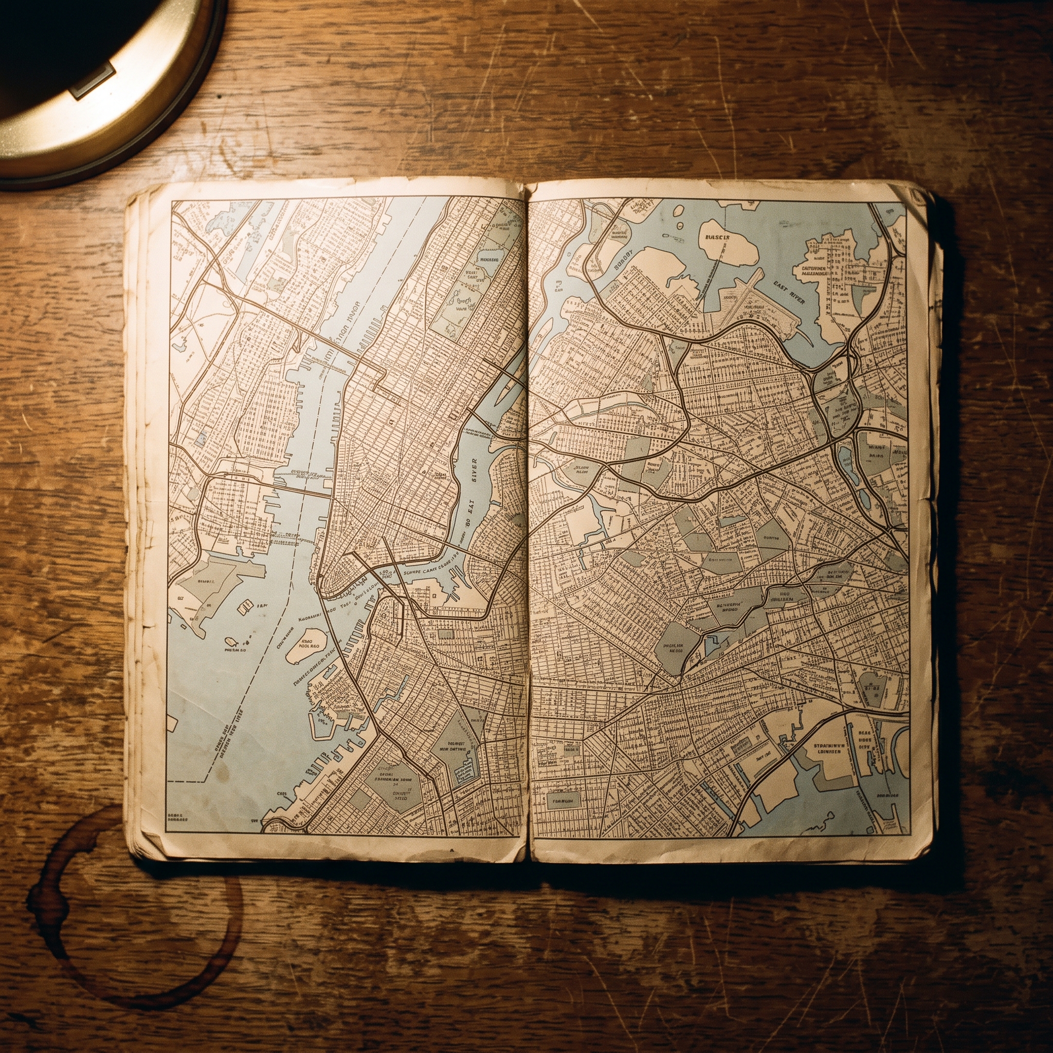
The Five Boroughs: Physical Scale and Form, 1989–2001
Subscribe
https://meridian-archive.com/feed.xmlOpen in your app, or paste the link above into any other:
The Configuration
The Triborough Bridge and Tunnel Authority ran its toll on the Verrazzano-Narrows Bridge, the only fixed link between Brooklyn and Staten Island, in one direction only. A car paid to cross south into Staten Island; the same car crossed north back to Brooklyn for nothing.1 This held for most of the twelve years this chapter covers, and it was administered without ceremony: the toll booths were staffed on the Brooklyn side and simply did not exist on the Staten Island side, so that a driver approaching the bridge from Bay Ridge paid a fare that the same driver, returning an hour later, did not. Gypsy cabs servicing the island built the asymmetry into their routing the way they built in traffic patterns; commuters built it into a daily arithmetic that most of them could not have explained to a visitor, because it had never occurred to them that it needed explaining.
Five boroughs. Four geographic conditions. Manhattan and Staten Island were islands; Brooklyn and Queens were the westernmost counties of Long Island; the Bronx was the mainland, contiguous with Westchester County to its north and separated from Manhattan only by the Harlem River, a tidal strait narrow enough to be bridged many times over and crossed by foot, car, and train. The political consolidation that produced the city in its modern form happened on January 1, 1898, when Greater New York absorbed Brooklyn — then the fourth-largest city in the United States — along with the Bronx, Queens, and Staten Island into a single municipality with Manhattan.2 The geographic logic of the five land-pieces was not redrawn. The political envelope was.
The numbers that resulted were not intuitive. Manhattan — the borough that most visitors meant when they said “New York” — was the smallest: 22.83 square miles.3 Queens was nearly five times larger, at 108.53 square miles. Brooklyn, at 70.82, was larger than Manhattan and Staten Island combined. The Bronx ran to 42.10. Staten Island, at 58.37, was the third-largest borough that almost no one from the other four thought of in those terms. Together they added up to 302.6 square miles, roughly the footprint of Berlin — a comparison that would mean something to a German reader and almost nothing to a Manhattanite who had not left the island in a month.

For a reader oriented to European cities, the proportions required adjustment. Manhattan was slightly larger than the City of London, the borough of Westminster, and the London Borough of Camden combined — but smaller than inner Berlin. The Bronx was about the size of Munich’s central districts. Brooklyn was comparable to inner Hamburg in area and considerably more populous. Queens was larger than the city of Frankfurt. Staten Island came to about half the area of the city of Bremen. A character moving from the Bronx to Brooklyn had crossed a distance comparable to crossing Greater London; the subway flattened this into a forty-minute ride, which made the geography easier to ignore than to absorb.
By 2000, the Census counted 8,008,278.4 The city had grown by nearly 700,000 people in a decade, with every borough gaining. The physical boundaries had not moved. It was not, in the obvious sense, an island city.
Manhattan, a Strip Two Miles Wide
The working dimensions of Manhattan were simpler than the borough’s reputation suggested. The island ran roughly 13.4 miles from the Battery at its southern tip to Marble Hill at the Harlem River in the north. Its maximum width was approximately 2.3 miles, near 14th Street; north of 96th Street the island narrowed, and at the Harlem River bridges it was at its slimmest.5 The total land area was 22.83 square miles — less than a quarter of Brooklyn’s.
Eric W. Sanderson’s Mannahatta reconstructed the island’s pre-grid topography from the 1782 British Headquarters Map cross-referenced with the 1811 Randel survey and other historical records: dozens of streams, 573 hills, and a terrain that the grid of 1811 would cover or flatten almost entirely.5 By 1989, what remained of that original landscape was mostly in Central Park, which occupied a rectangle two and a half miles long by a half-mile wide between 59th and 110th Streets — a green interruption running down the spine of the upper island.
The practical geometry of a magazine office in Midtown was this: a desk at Madison Avenue and 52nd Street was six minutes’ walk west to Sixth Avenue, four minutes east to Park, two minutes east to Fifth. An editor who crossed the island at lunch and returned was back at her desk in twenty minutes. North-south distances were the ones that required a subway. The 1 train from South Ferry to 242nd Street covered the full length of the island in just over an hour.
A non-resident who learned the city from Manhattan first absorbed a wrong scale. The other four boroughs were larger, sometimes much larger. Queens alone was nearly five times Manhattan’s area. To mistake Manhattan for the city was a comprehensible error — the density of the place, the concentration of its institutions — but it was still an error. A strip, not a region.
The Grid
In 1811, three commissioners appointed by the New York State Legislature imposed a grid on the undeveloped land above Houston Street. The plan called for twelve numbered avenues running north-south and 155 numbered streets running east-west, surveyed and plotted with no particular regard for topography.6 Hilary Ballon’s The Greatest Grid documents the commissioners’ stated reasoning — drainage, speculative subdivision, the rectangular city as administrative form — and their indifference to the hills and streams below their lines. The hills were leveled. The streams were buried. The grid arrived.
Below Houston Street, the colonial pattern persisted. Greenwich Village, SoHo, Tribeca, and the Financial District were laid out before the commissioners acted, and they showed it. Bleecker Street crossed Sixth Avenue twice. West Fourth Street crossed West Tenth. A non-resident navigating below 14th Street without local knowledge gave up within a block.
Above 14th, the grid mostly worked. The walking-pace arithmetic was learnable: twenty north-south blocks to the mile, three east-west long blocks between avenues to the mile. Fifth Avenue divided East and West. The address algorithm for avenue numbers required a conversion table, which appeared on the inside front cover of every Hagstrom map and on the back of no other document in common circulation. Old New Yorkers carried the table in their heads.
The avenue renames added a layer. Sixth Avenue had been officially the Avenue of the Americas since 1945; no New Yorker used that name. Above 59th Street, Ninth Avenue became Columbus, Tenth became Amsterdam, Eleventh became West End. Above 110th Street in West Harlem, Sixth became Lenox Avenue — also Malcolm X Boulevard since 1987 — while Seventh became Adam Clayton Powell Jr. Boulevard and Eighth became Frederick Douglass Boulevard.6 These names were not interchangeable in the neighborhoods where they applied. A senior editor who called Lenox Avenue “Sixth” uptown was marking herself as someone who had not been there.
The grid was the achievement and the limit.
Brooklyn and Queens, the End of Long Island
Brooklyn and Queens were, geologically, part of Long Island. The same terminal moraine of the Wisconsin glaciation that formed the ridge running through the center of Long Island ran under them as well. Their bedrock was not Manhattan’s schist. Their terrain — flatter, more continuous with the land to the east — reflected the difference. When a character crossed the East River from Manhattan into Brooklyn or Queens, she crossed not merely a borough line but a geologic boundary.
Together Brooklyn and Queens occupied 179.35 square miles — more than half the city’s total land area.3 In 1990 they held 4,252,262 people, against Manhattan’s 1,487,536. More than three-fifths of New Yorkers lived east of the East River, in boroughs that shared a landmass with Nassau County and Suffolk County and eventually, a hundred miles east, with the Hamptons. The city’s demographic center of gravity was not on the island most people meant when they said “the city.”
The fixed links between Manhattan and the two eastern boroughs had been built in three phases. The Brooklyn Bridge opened in 1883; the Williamsburg and Manhattan Bridges followed in 1903 and 1909 respectively, along with the Queensboro at 59th Street.7 The tunnels came later: the Steinway Tunnel for the 7 train, the Queens-Midtown vehicular tunnel in 1940, the Brooklyn-Battery in 1950. Each crossing reduced the friction of the East River by a small increment without eliminating it. A senior editor at a Madison Avenue magazine was nine miles in a straight line from Flushing and twelve from Howard Beach. The subway compressed those distances into fifteen-minute and fifty-minute trips respectively. The geography did not compress.
Brooklyn’s street grid ran at its own angle to Manhattan’s, oriented to the compass as Brooklyn had been oriented before the consolidation. Queens’ grid was its own, laid out by nineteenth-century speculators in several separate surveys that did not align with one another. A character navigating by Manhattan instincts into either borough found the grid offering no guidance at the moment she expected it most.
The fact that Brooklyn and Queens were geologically Long Island — and not the same kind of land as Manhattan — was the sort of thing a non-resident learned and forgot and learned again. The western terminus of an island that ran east for another hundred miles.
The Bronx, the Only Mainland Borough
The Bronx was physically attached to the continental United States. To its north lay Westchester County, with no river between them. The Harlem River, a tidal strait, separated it from Manhattan to the south; the East River put it across from Queens to the southeast; the Hudson ran along its western flank as the boundary with New Jersey. But these were all crossable water. The Bronx’s northern edge was a land border, and what lay beyond it was the commuter suburbs — Yonkers, Mount Vernon, New Rochelle, Larchmont — connected by road and rail without a river crossing.3
In 1990, the Bronx held 1,203,789 people; by 2000, the figure was 1,332,650, a percentage increase higher than Brooklyn’s or Manhattan’s during the same period.4 The decade’s recovery was visible in the numbers before it was visible on the street.
The borough’s physical continuity with the mainland had practical consequences. The Bronx received cold fronts off the continental mass before any other borough. Meteorologically, winter arrived there first. The housing stock concentrated in Bedford Park, Riverdale, and the strips of the South Bronx that had survived the 1970s — the decade of arson, disinvestment, and abandonment that had left sections of the Morrisania and Hunts Point neighborhoods with more empty lots than buildings — was, in the surviving sections, pre-war construction, dense and tenement-scaled, not entirely unlike sections of upper Manhattan.
The Cross Bronx Expressway, Robert Moses’s east-west cut through the borough, had been built section by section between 1948 and 1963, demolishing neighborhoods in its path and accelerating the disinvestment that followed.1 By 1989 the expressway was a fact of the borough the way the Hudson was a fact: it was there, it had produced its consequences, and those consequences were the landscape. A Riverdale doorman crossing the Henry Hudson Bridge into Manhattan in the dark before dawn was crossing a river into a different borough, which was, for most intents, a different world. Not an island. But not entirely not one.
Staten Island, the Ferry Borough
Staten Island was the most physically separate borough. At 58.37 square miles it was the third-largest by area; at 378,977 people in 1990, growing to 443,728 by 2000, it was the smallest by population and growing faster than the city average.34 The two facts together described a borough with room to expand into — a condition no other borough shared.
From Manhattan, Staten Island was reachable only by ferry. The Staten Island Ferry departed from the Whitehall Street terminal at the southern tip of Manhattan on a regular schedule and made the crossing to the St. George terminal on the island’s north shore in roughly twenty-five minutes, through the upper bay, past the Statue of Liberty, past Governors Island. The fare was a small one through much of the period — fifty cents each way — and was eliminated in the late 1990s, after which the crossing was free. The ride was used primarily by commuters and ignored by Manhattan residents with the categorical efficiency of all good things nearby.
From Brooklyn, the island was reachable only by the Verrazzano-Narrows Bridge, opened November 21, 1964 — a double-deck suspension span designed by Othmar Ammann and, at the time of its opening, the longest suspension bridge in the world.1 Robert A. Caro’s The Power Broker traces Moses’s pursuit of the crossing across three mayoral administrations and a succession of engineering proposals, as the project that closed the last gap in the borough system.
Politically and culturally, Staten Island was the most distinct borough. It leaned Republican through the period and was described by its own residents and by everyone else as suburban in character, a word that in the context of the five boroughs was not neutral. A borough crossed by water on every side, facing the continent, and arranged around a bridge it had waited until 1964 to receive.

The Bridges
Twenty-three bridges and tunnels connected the boroughs to one another, to the mainland, and to New Jersey. The system was the engineered correction to the geographic fact that the city was mostly water — a problem that had required eighty-one years to solve completely, from the opening of the Brooklyn Bridge in 1883 to the opening of the Verrazzano-Narrows in 1964.7
The crossings divided along a line that was both financial and political. Tolled crossings to New Jersey and Staten Island — the George Washington Bridge (1931), the Holland Tunnel (1927), the Lincoln Tunnel (1937), the Goethals Bridge (1928), the Bayonne Bridge (1931), the Outerbridge Crossing (1928), and the Verrazzano-Narrows — generated revenues that funded the Triborough Bridge and Tunnel Authority, the agency Robert Moses had built into the most powerful public authority in the state’s history.1 Tolled intra-city crossings — the Triborough itself (1936), the Bronx-Whitestone (1939), the Throgs Neck (1961), the Henry Hudson (1936), the Queens-Midtown Tunnel (1940), the Brooklyn-Battery Tunnel (1950) — operated on the same principle: the toll funded the agency that collected the toll.
Free intra-city crossings were the older ones. The Brooklyn Bridge (1883), the Manhattan Bridge (1909), the Williamsburg Bridge (1903), and the Queensboro at 59th Street (1909) predated Moses’s authority and had never been made to pay for themselves in cash.7 The Harlem River bridges that stitched Manhattan to the Bronx — the Washington Bridge (1888), the University Heights Bridge (1908), the Madison Avenue Bridge (1910), the 145th Street Bridge (1905), Macombs Dam (1895), the Third Avenue Bridge (1898), the Willis Avenue Bridge (1901) — were municipal infrastructure of an older kind, built on the logic that the Bronx was part of the same city and its residents should be able to reach the rest of it without paying. The High Bridge of 1848, the city’s oldest standing bridge, had been closed to pedestrians since 1970 and remained closed throughout the period.
The George Washington Bridge carried more vehicle traffic than any other bridge in the world.7 Sharon Reier’s The Bridges of New York — published originally by Quadrant Press in 1977, reprinted by Dover in 2000 — was the standard reference for engineering specifications, opening dates, and reconstruction history. It was the kind of book kept on a shelf, not carried in a coat pocket.
The free-versus-tolled distinction was character-relevant in ways that did not announce themselves. A 1991 cab from Midtown Manhattan to LaGuardia Airport could go over the Triborough Bridge and pay the toll, or it could go up to the 59th Street Bridge — free — and work out to Queens from there, along the BQE, adding minutes to avoid the dollar-fifty. The driver made the calculation at 96th Street. The passenger noticed, or did not.
The bridges were the achievement that allowed the rest of the city to be habitable from any of the rest of it. The system was so successful that the geography it corrected became, for most New Yorkers, invisible. An engineered city.
The five boroughs were five different physical conditions, made administratively one in 1898 and made physically continuous by a century of engineering that finished its work in 1964 — the year the Verrazzano bridge closed the last open water. They were never the same kind of place. Manhattan a strip, its grid locked above 14th and its colonial streets unnavigable below it. The Bronx mainland, its northern edge a land border rather than a river. Brooklyn and Queens the western terminus of Long Island, carrying their own grids, their own geology, more than half the city’s land and three-fifths of its people. Staten Island ringed by water, reachable by ferry and by one bridge, facing the harbor with its back to the rest of the city. The achievement of the bridges was real: by 1989 a New Yorker could move from any borough to any other without touching open water on foot, could put the crossings so far into the background of daily life that the geography producing them went unnoticed. The Brooklyn Bridge had been making this argument since 1883. The city’s physical scale was the first thing a non-resident had to learn, and the first thing the residents had successfully stopped noticing — which left everything the scale contained still waiting to be seen.
A major crossing — the George Washington Bridge at sixty, in 1991, or the Brooklyn Bridge’s ongoing repainting, a photogenic operation that would have generated reliable editorial content — would have turned into a clean architectural feature almost on its own: the engineering, the history, the view from the cables. Competent, usable in the back of the well, and easy to staff. The geography of the floor itself would have been a different matter. Where everyone lived. What the commute was. Why the people producing the magazine would, between them, have seen almost nothing of Queens, or of the eastern Bronx, or of the South Shore of Staten Island, except on assignment. The subject would have surfaced once, at a Monday meeting, and died there — not for want of a writer but because the piece would have had to name the masthead itself. The addresses in it would have been the editors’ own addresses, the commutes their own commutes, and nobody would have signed a story whose reporting consisted of describing the people who would then edit it. Two weeks later nobody would have been able to say whose idea it had been.
An assistant in the art department would have lived in St. George, a walk up the hill from the ferry terminal, and would have made the crossing twice a day — twenty-five minutes over open water, past the Statue of Liberty, past Governors Island, fifty cents each way. She would have been the only person on the floor who crossed the harbor to reach it. She would have stood at the rail on the warm mornings and sat inside the glass on the cold ones, and the water would have been the first thing she saw each working day and the last. Nobody at the light-boxes would have known which borough she came in from. She would not have offered it. Hers would have been the longest open-water commute in the building, and on the floor it would have amounted to nothing at all — not geography, not material, not even a fact. It would have been the part of her day that happened before her day began.
Footnotes
-
Robert A. Caro, The Power Broker: Robert Moses and the Fall of New York (Alfred A. Knopf, 1974). ↩ ↩2 ↩3 ↩4
-
Mike Wallace, Greater Gotham: A History of New York City from 1898 to 1919 (Oxford University Press, 2017). ↩
-
U.S. Census Bureau, 1990 Census of Population and Housing, Population and Housing Unit Counts: New York (CPH-2-34), Washington, D.C.: U.S. Government Printing Office, 1993. ↩ ↩2 ↩3 ↩4
-
U.S. Census Bureau, Census 2000 Summary File 1, New York, Washington, D.C.: U.S. Department of Commerce, 2001. ↩ ↩2 ↩3
-
Eric W. Sanderson, Mannahatta: A Natural History of New York City (Abrams, 2009). ↩ ↩2
-
Hilary Ballon, ed., The Greatest Grid: The Master Plan of Manhattan, 1811–2011 (Museum of the City of New York / Columbia University Press, 2012). ↩ ↩2
-
Sharon Reier, The Bridges of New York (Dover Publications, 2000; originally Quadrant Press, 1977). ↩ ↩2 ↩3 ↩4